Ireland lies to the west of the island of Great Britain, and is divided into the Republic of Ireland and Northern Ireland (part of the UK).
Republic of Ireland
The Republic of Ireland is an independent state, having left the British Commonwealth in 1949. A country with a rich turbulent past, with the arrival of Celts, bloody and ruthless Vikings and British invasions, and its severe hardships have somehow shaped the Ireland of today.
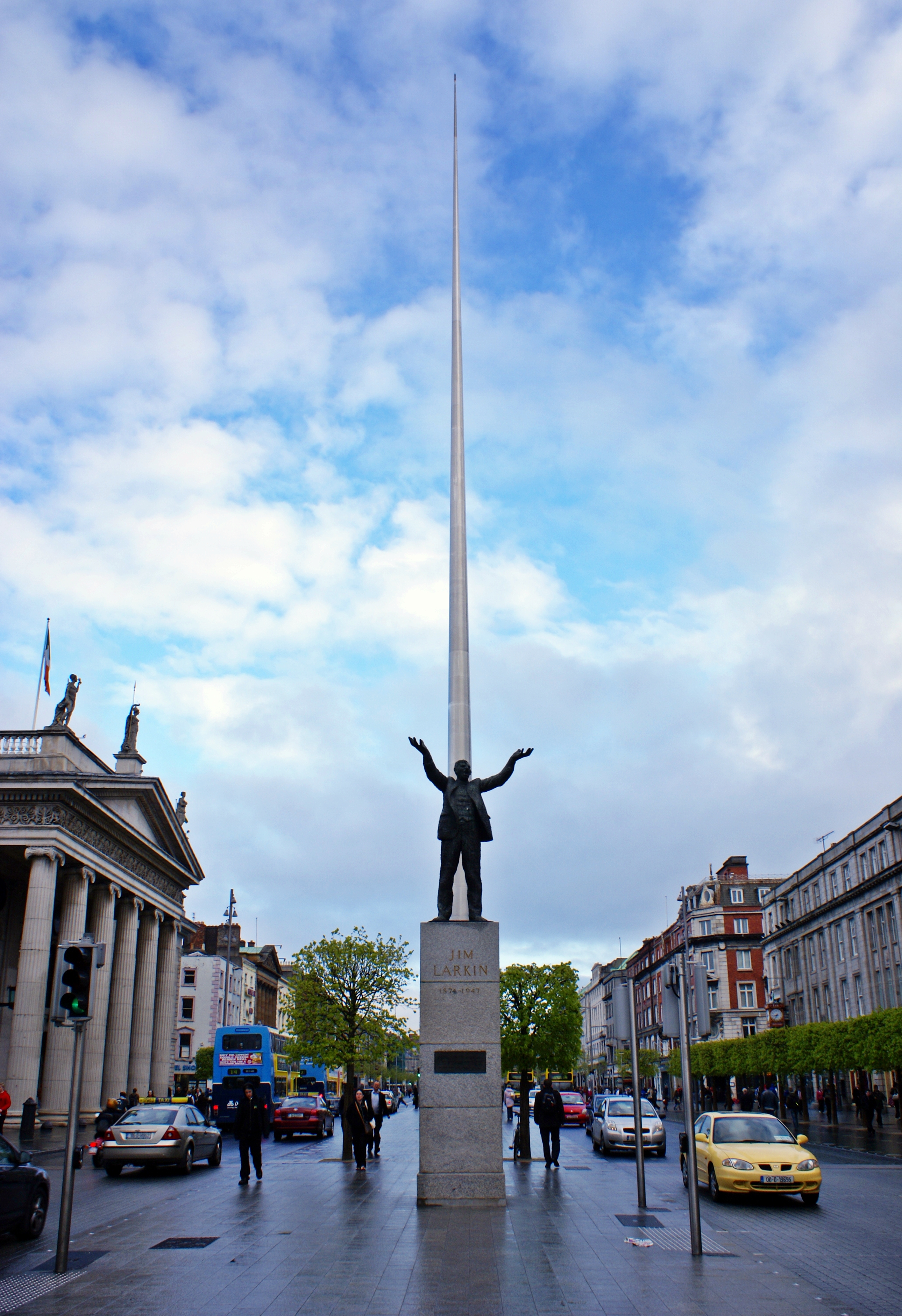 |
| Looking up O'Connell Street with the statue of Jim Larkin in view, Photo Image © Wikipedia |
Dublin:
Dublin, the capital of Ireland, lies at the mouth of the River Liffey, on Dublin Bay, an inlet of the Irish Sea.
St. Patrick converted the people of Dublin to Christianity in the 5th Century, and in the 9th Century, Vikings invaded and conquered and eventually developed the town into a major port and trading centre. In the 12th Century, the Anglo-Normans invaded Ireland, and the country was under English rule until 1921, when Ireland was partitioned. The southern portion of the island became a Free State encompassing 26 counties.
 |
| Dublin Skyline, Photo Image © Wikepedia |
Dublin is city best explored on foot. Things to see include:-
- The Trinity College, located in the heart of the city, is home to the Book of Kells, an illuminated manuscript of the Four Gospels written about 800AD by Irish Monks. It is a masterwork of Western calligraphy and represents the pinnacle of Insular illumination. For example, it contains figures of humans, animals and mythical beasts, together with Celtic knots and interlacing patterns in vibrant colours that enliven the manuscript’s pages.
- Molly Malone Statue
- Temple Bar Area
 |
| Statue of Molly Malone on Grafton Street (Sráid Grafton), Dublin, Photo Image © Wikepedia |
County Clare:
County Clare contains The Burren, a unique karst region, which contains rare flowers and fauna. At the western edge of The Burren, facing the Atlantic Ocean, are the Cliffs of Moher.
 |
| Panorama from below O'Brien's Tower, The Cliffs of Moher, Photo Image © Wikipedia |
The cliffs boasts one of Ireland’s most spectacular views, rising 394 feet above the Atlantic Ocean at Hag’s Head, and reaches a maximum of 702 feet just north of O’Brien’s Tower.
County Cork:
County Cork is the most southerly and largest of the traditional Counties of Ireland, and was named after the city of Cork.
Attractions to Cork include the Blarney Stone and Cobh, the port where many Irish emigrants boarded for their voyage to the United States, Australia, Canada, New Zealand, or South Africa and also the last stop of the Titanic, before departing on its fated journey.
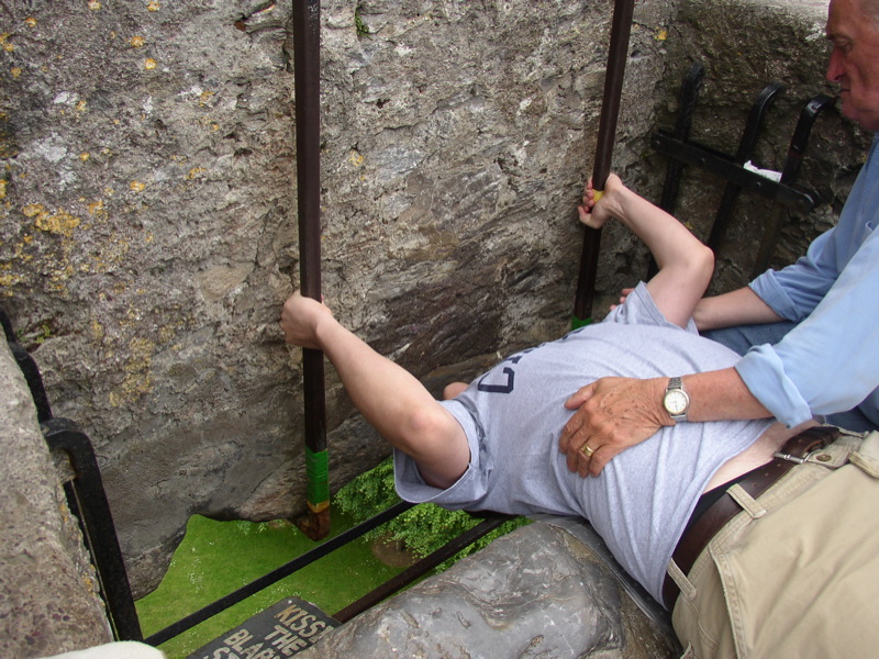 |
| Kissing the Blarney Stone at Blarney Castle, Ireland, Photo Image © Wikipedia |
The Blarney Stone is a block of bluestone built into the battlements of Blarney Castle, Blarney about 8 km from Cork. According to legend, kissing the stone endows the kisser with the gift of gab (greater eloquence or skill at flattery). To touch the stone with one’s lips, the participant must ascend the castle’s peak, then lean over, backwards, on the parapet’s edge. Prior to safety measures now installed, kissing the stone used to be a real risk to life and limb, as participants were grasped by the ankles and dangled bodily from the height. Eww!
Northern Ireland
 |
| Beacon of Hope Sculpture, Belfast, Photo Image © Karen Toh, 2010 |
 |
| Harland and Wolff Shipyard, Belfast, Photo Image © Karen Toh, 2010 |
Belfast:
Belfast is the capital of Northern Ireland. Historically, Belfast’s economy thrived on its production of Irish linen, tobacco production, rope-making and shipbuilding. The city’s main shipbuilders, Harland and Wolff, which built the RMS Titanic, became the largest and most productive shipyard in the world.
 |
| The Boat, Customs House Square, Belfast, Photo Image © Karen Toh, 2010 |
Belfast still struggles with its violent past, but has rebuilt itself from the destruction of the Troubles. The best way to see Belfast is on a Hop On Hop Off Bus Tour, giving you a deeper understanding of the historical background of the area and country.
Other sights worth seeing near Belfast:-
- Ulster Folk & Transport Museum - De Lorean car
- Mount Stewart House, Garden and Temple of the Winds
- Strangford Lough Wildlife Centre
Causeway Coastal Route:
The Causeway Coastal Route is a way-marked 120 mile trail of outstanding scenic drives and attractions around the coast of Northern Ireland between the cities of Belfast and Londonderry, which taken together, make up what has deservedly been described as 'one of the world's great road journeys'.
Our journey started from Carrickfergus through Cushendun, Ballycastle before our turnoff into Bushmills where we stayed.
 |
| Carrickfergus Castle, Photo Image © Karen Toh, 2010 |
Carrickfergus:
Carrickfergus Castle is a castle with Norman Architecture, situated in the town of Carrickfergus. Besieged in turn by the Scots, Irish, English and French. The castle played an important military role until 1928 and remains one of the best preserved medieval structures in the whole of Ireland. It was useful as 3/4 of the perimeter is covered by water.
 |
| Ballycastle, Photo Image © Karen Toh, 2010 |
Ballycastle:
Ballycastle is a small seaside town located on the most north-easerly tip of county Antrim in Northern Ireland, surrounded by breath-taking beauty.
 |
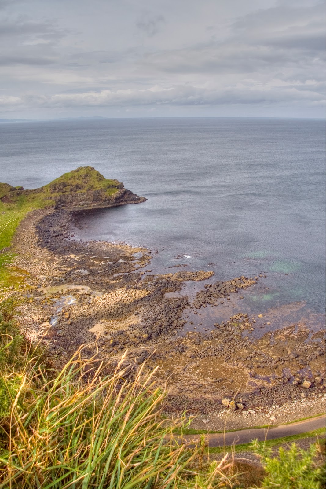
| View from Ballycastle, Photo Image © Karen Toh, 2010 |
 |
| Causeway Coastal Route, Photo Image © Karen Toh, 2010 |
Giant’s Causeway:
The Giant’s Causeway is Northern Ireland’s only UNESCO World Heritage Site, renowned for its polygonal columns of layered basalt resulting from a volcanic eruption 60 million years ago.
The formation of the Giant's Causeway was due to intense volcanic activity. Lava welling up through fissures in the chalk bed formed a "lava plateau". Three periods of volcanic activity gave rise to the Lower, Middle and Upper Basalts, and it's the Middle Basalt rock which forms the famous amphitheatres of hexagonal columns in the Causeway.
 |
| Giant's Causeway, Photo Image © Karen Toh, 2010 |
 |
| Giant's Causeway, Photo Image © Karen Toh, 2010 |
 |
| Giant's Causeway, Photo Image © Karen Toh, 2010 |
 |
| Giant's Causeway, Photo Image © Karen Toh, 2010 |
 |
| Giant's Causeway, Photo Image © Karen Toh, 2010 |
 |
| Giant's Causeway, Photo Image © Karen Toh, 2010 |
 |
| Chimney Stacks, Giant's Causeway, Photo Image © Karen Toh, 2010 |
Weathered formations have created circular structures round a core of basalt which are known locally as "giant's eyes". Some other formations with popular names are the Chimney Stacks, The Harp, The Organ and the Camel's Hump.
Visitors to the area can walk along the cliffside all along the causeway. The Shepherd Steps takes you from the cliff top to the bottom.
 |
| Dunseverick Castle, Photo Image © Karen Toh, 2010 |
 |
| Dunseverick Castle, Photo Image © Karen Toh, 2010 |
 |
| Dunseverick Castle, Photo Image © Karen Toh, 2010 |
 |
| View from Dunseverick Castle, Photo Image © Karen Toh, 2010 |
Dunseverick Castle:
The ruins of Dunseverick Castle can be found near the small village of Dunseverick and the Giant's Causeway. It was a key ancient site in Ireland, having been occupied by various Irish chiefs and lords, and what used to be a fortress. You would never have guessed that this distinguished castle once stood at the same spot and area which was popular enough to attract a number of visits from Saint Patrick himself.
 |
| Dunluce Castle, Photo Image © Karen Toh, 2010 |
Dunluce Castle:
Dunluce Castle is a medieval castle ruin located on the edge of a basalt cropping in County Antrim between Portballintrae and Portrush. Richard de Burgh, Earl of Ulster first built this castle at Dunluce in the thirteenth century. The castle has seen many seiges and battles during its long history.
 |
| Carrick-a-Rede Rope Bridge, Photo Image © Karen Toh, 2010 |
Carrick-a-Rede:
Carrick-a-Rede Rope Bridge, originally consisted of a single rope which local fishermen erected over a 23m-deep and 20m-wide chasm to check their salmon nets. Today this has been replaced by a a two handrailed bridge.
 |
| Carrick-a-Rede Rope Bridge, Photo Image © Karen Toh, 2010 |
If you have a thing for heights and shaky bridges.. you may want to rethink this walk! :p If you look at the picture below, you may be able to make out the ant-sized people walking across the bridge.
Views around the area are also breathtaking!
LondonDerry:
Derry or Londonderry is the second-biggest city in Northern Ireland. In 1613, the city was granted a Royal Charter by King James I and the "London" prefix was added, changing the name of the city to Londonderry.
 |
| Rainbow over LondonDerry from the River Foyle, Photo Image © Karen Toh, 2010
|
 |
| A view of Derry from the River Foyle, Photo Image © Karen Toh, 2010 |
Like most of Ireland, Derry too has struggled with its past. Catholics were discriminated against under Unionist government in Northern Ireland, both politicially and economically, and on Sunday January 30, 1972, 13 unarmed civilians were shot dead by British paratroopers during a civil rights march in the Bogside area. 13 others were wounded and one man later died of his wounds. The event is known as Bloody Sunday.
Mussenden Temple and Downhill Demesne:
Mussenden Temple and Downhill House are located near Castlerock, now a part of the National Trust under the property of Downhill Demesne and Mussenden Temple.
The Mussenden Temple is a small circular building perched atop a cliff, was orignially built as a library and modelled on the Temple of Vista in Italy. Over the years, the erosion of the cliff face at Downhill has brought the temple ever closer to the edge.


No comments:
Post a Comment